
San Francisco Neighbourhoods: A Plain-Language Breakdown
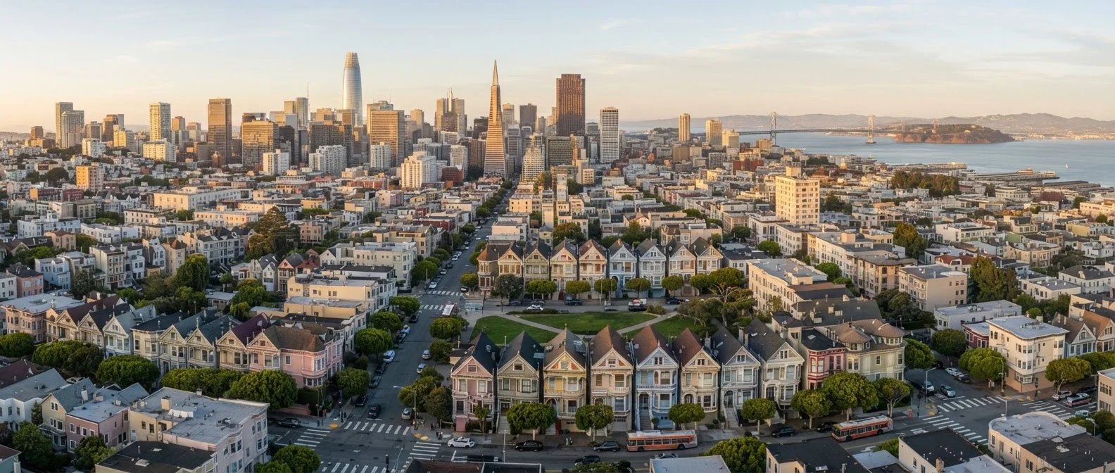
Photo credit: PrimeReads.net | Discover Insightful And Creative Blogs
In this article
From the Mission to the Sunset, each SF neighbourhood has a distinct feel. Find out which suits your travel style.
How San Francisco's Neighborhoods Are Organized
San Francisco packs remarkable diversity into 49 square miles. Rather than spreading across a metro sprawl, the city concentrates distinct neighborhoods - each with its own topography, culture, and pace - within walking or transit distance of one another. Understanding a few geographic anchors helps orient any visitor.
The city broadly divides into the East Side (warmer, sunnier, denser), the West Side (foggy, residential, quieter), and central corridors that blend both. The northeast quadrant holds most of the tourist-heavy landmarks: Fisherman's Wharf, Chinatown, and the Financial District. Moving south and west, neighborhoods become more residential and locally oriented.
| Total city area | 49 square miles |
| Number of distinct neighborhoods | Approximately 36 recognized neighborhoods (SF Planning Department) |
| Foggiest districts | Outer Sunset, Richmond, Twin Peaks |
| Warmest districts | Mission District, Dogpatch, Potrero Hill |
| Primary transit system | Muni (buses, light rail, cable cars) (SFMTA) |
| Walkability | High in most neighborhoods; hills require planning |
Public transit - specifically the Muni bus and rail network and the BART subway system - connects most neighborhoods efficiently. A Clipper card or contactless payment simplifies transfers.
Key Neighborhoods and What to Expect
The Mission District
The Mission is the city's cultural and culinary heartbeat. Expect vibrant murals on nearly every block, taquerias serving late into the night, and a mix of long-standing Latino families alongside newer tech-era residents. Dolores Park draws crowds on sunny afternoons. The Mission runs warmer and sunnier than most of the city, making it an appealing base for those sensitive to SF's famously heavy fog.
The Castro
One of the most historically significant LGBTQ+ neighborhoods in the U.S., the Castro combines lively nightlife with a strong sense of community identity. The Victorian architecture is well-preserved, independent bookstores and boutiques line the main commercial strip, and the area is highly walkable.
Haight-Ashbury
The Haight's 1960s counterculture legacy is still visible in vintage clothing shops and record stores, but the neighborhood has evolved into a mixed residential and shopping district. Its proximity to Golden Gate Park makes it a convenient launching point for a half-day of outdoor exploration.
The Sunset and Richmond
These two large western neighborhoods are residential and quieter - think neighborhood cafés, dim sum restaurants, and the occasional Ocean Beach sunset. They attract visitors who prefer a slower pace and lower accommodation prices relative to more central areas. Both border Golden Gate Park, offering easy access to the park's museums and green space.
SoMa and the Tenderloin
South of Market (SoMa) holds many of the city's museums, music venues, and convention spaces. It transitions sharply in character block by block. The adjacent Tenderloin is a high-density, low-income area with significant social challenges; visitors should be situationally aware and review current local advisories before exploring.
North Beach and Chinatown
North Beach retains its Italian-American café culture alongside its Beat Generation literary history. City Lights Bookstore is a genuine historic landmark. A short walk downhill leads into Chinatown - one of the oldest and most densely populated in North America - where herb shops, dim sum parlors, and produce markets line Grant Avenue. Much like visiting New York's distinct neighborhoods, navigating SF rewards those who move past the obvious tourist corridors.
Practical Tips for Moving Between Neighborhoods
San Francisco's hills are not decorative - they are genuinely steep and can make walking between neighborhoods physically demanding. Apps that show elevation gain alongside walking time are useful for route planning.
- Cable cars are functional transit, not just a tourist attraction; they connect Powell Street to Fisherman's Wharf and Chinatown efficiently.
- Muni Metro lines (the underground light rail) run through the central corridor and out to the Sunset and Castro.
- BART is most useful for airport connections and travel to the East Bay, with limited coverage within SF itself.
- Rideshare and taxi services are widely available but can be slow during peak hours due to traffic congestion and limited parking supply.
Neighborhoods can shift in character significantly from one block to the next. Checking current travel advisories through official city and government sources before your trip provides the most accurate picture of local conditions.

Author
Travel Editorial Team
Travel Editorial Team is the collective byline for our editorial team and contributor network. Articles published under this byline or an editorial pen name are researched, written, and reviewed according to our editorial standards for clarity, consistency, and independence before publication.
View all articles →